London reached highs above 18C with Kew Gardens hitting 18.6C; Saharan dust boosted sunset colours while researchers highlight rising flood risk across the UK
The trending moment
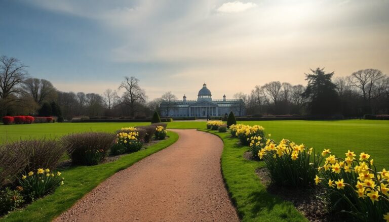
A break in the recent run of rain gave the capital a noticeably milder day. Temperatures nudged into the high teens, with the Met Office noting 18.6°C at Kew Gardens and several southeast sites topping 17°C.
A clear blue sky and a gentle southerly breeze lifted warmer air from lower latitudes. Pockets of morning fog dogged a few sheltered hollows but soon burned off, leaving bright afternoons and an easy, spring-like feel.
What happened
Synoptic charts showed a pressure pattern that steered a southerly flow across the region, thinning cloud and allowing daytime heating to do its work.
Observations from the Met Office and regional stations indicate the warmth came mainly from that incoming air mass rather than local effects. Where fog did reform overnight, it faded again as sunshine strengthened and the breeze freshened.
Why it mattered
After weeks of cool, wet weather, the short warm interlude was more than pleasant — it reshuffled plans.
People turned garden tasks back on the to-do list, cafés and parks drew bigger crowds, and retailers saw a small uplift in footfall as coats came off. These southerly incursions are typical during seasonal transitions: brief but influential, they nudge behaviour and mood even if they don’t linger.
How the warmth compared regionally and abroad
That day London’s mercury rivalled some Mediterranean spots — forecasts put Ibiza near 18°C, Málaga about 16°C and Barcelona around 14°C. Parts of Kent and Suffolk recorded readings close to the capital’s high, underlining how the milder air spread across a broad sweep of southeast England and pushed daytime temperatures above what’s typical for the time of year.
Saharan dust: the small particles behind dramatic sunsets
Riding with the milder air was a high-altitude plume of Saharan dust. Fine mineral grains scatter low-angle sunlight, often deepening reds and oranges at sunrise and sunset. When those particles mix with rain they can leave a faint reddish film on surfaces — the phenomenon sometimes called “blood rain.” These dust events are most likely in late winter and spring, when southerly winds tap North African air.
Expert perspective
Atmospheric scientists stress that the sky’s colour and any surface deposits depend on how concentrated the dust is aloft and the sun’s angle. A strong dust layer high in the atmosphere can intensify sunset hues without necessarily worsening ground-level air quality; however, when dust is scavenged by raindrops it can settle onto cars, windows and pavements. The residue is largely inert mineral matter, though it can carry soil microbes and nutrients. People with asthma or other respiratory sensitivities should stay alert to air-quality updates and limit vigorous outdoor exertion if they notice symptoms.
Practical impacts and advice
Photographers made the most of richer golds and reds during the evening golden hour, while homeowners found a brief respite for outdoor chores. A light rinse after showers helps remove any dusty film from patios and vehicles. Authorities recommend routine vehicle washes to avoid long-lasting deposits and advise vulnerable individuals to monitor air-quality forecasts. Forecasting of dust transport has improved in recent years, making short-range predictions more reliable for public messaging and for anyone planning shoots or outdoor events.
From heavy rain to flood risk: the wetter backdrop
This mild day arrived against an unusually soggy start to the year. Several Met Office sites have recorded much higher-than-normal rainfall: Culdrose in Cornwall has seen roughly 2.25 times its usual amount, while Aboyne in Aberdeenshire received nearly four times its January average of 68.9 mm. Those departures leave soils saturated and rivers fuller than usual, cutting the landscape’s capacity to absorb further rain and raising the likelihood of surface-water flooding during new downpours.
What that means locally
When the ground is sodden and river levels are up, drainage systems struggle and runoff has nowhere to go — conditions that make flash flooding more likely. Reservoir operators and river authorities are keeping a close eye on levels. Practical steps for residents include avoiding low-lying roads during heavy rain, signing up for local flood alerts, and checking on neighbours who may be vulnerable.
Short-term outlook
The southerly flow that brought warmth should be intermittent; models point to a return of more variable conditions as pressure patterns shift. Expect brief milder spells interspersed with showery periods, so blue skies won’t be guaranteed for long stretches. Keep an eye on the latest forecasts if you have outdoor plans.
What happened
Synoptic charts showed a pressure pattern that steered a southerly flow across the region, thinning cloud and allowing daytime heating to do its work. Observations from the Met Office and regional stations indicate the warmth came mainly from that incoming air mass rather than local effects. Where fog did reform overnight, it faded again as sunshine strengthened and the breeze freshened.0
What happened
Synoptic charts showed a pressure pattern that steered a southerly flow across the region, thinning cloud and allowing daytime heating to do its work. Observations from the Met Office and regional stations indicate the warmth came mainly from that incoming air mass rather than local effects. Where fog did reform overnight, it faded again as sunshine strengthened and the breeze freshened.1
What happened
Synoptic charts showed a pressure pattern that steered a southerly flow across the region, thinning cloud and allowing daytime heating to do its work. Observations from the Met Office and regional stations indicate the warmth came mainly from that incoming air mass rather than local effects. Where fog did reform overnight, it faded again as sunshine strengthened and the breeze freshened.2
