Met Office warns of potential freezing rain and travel disruptions across the country.
Severe weather conditions expected across the UK
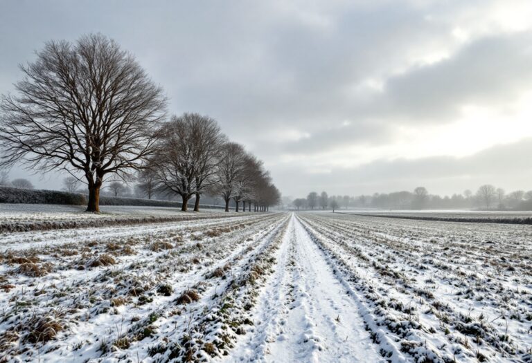
The United Kingdom is bracing for a notably cold weekend as the Met Office has issued a yellow weather alert for snow and ice. This alert comes in response to forecasts predicting a significant drop in temperatures, with some regions expected to experience freezing rain.
As the year began with a chill, the weather is set to take a turn for the worse, with Scandinavian and Atlantic gales expected to sweep across the country.
Snowfall predictions and affected regions
Weather forecasts indicate that temperatures could plummet below zero from today through Sunday, with parts of Scotland, including cities like Inverness and Edinburgh, likely to see up to 1cm of snow per hour starting from 9 AM on Saturday.
The northeast coast, particularly areas like Durham and Newcastle, will also experience light snow alongside rain. Further south, cities such as Manchester and regions in Northern Ireland and Wales are expected to witness snowfall, while the South West, including Bath and Bristol, will be drenched by rain.
Travel disruptions and safety warnings
The Met Office has cautioned that the weather could significantly impact travel, with longer journey times anticipated for road, bus, and train services. The yellow weather alert is in effect from 6 AM to 2 PM on Saturday, covering a wide area from the Scottish borders to Yorkshire. Travelers are advised to be cautious of icy patches on untreated roads, pavements, and cycle paths, as slips and falls may lead to injuries.
Expert insights on the upcoming weather
Matthew Lehnert, Chief Meteorologist at the Met Office, stated that as rain moves eastward, it will encounter colder air, leading to snowfall, particularly in Northern England. He noted that accumulations of 2 to 5 cm are possible in areas like the Cheviots and North York Moors, with localized accumulations at lower levels also likely. Additionally, some freezing rain could affect higher elevations in the Pennines, contributing to icy conditions.
Long-term weather outlook
Looking ahead, the Met Office has indicated that colder conditions and wintry showers are expected to persist throughout the latter half of February. Their long-range forecast suggests that while southeasterly winds will maintain below-average temperatures, there is potential for even colder conditions to develop, particularly in northeastern areas. As frontal zones attempt to bring milder weather from the west, the transition between cold and milder conditions remains uncertain, but the likelihood of snow increases as these systems push northeastward.
