Adverse weather conditions in Wales lead to speed restrictions and multiple flood alerts as strong winds impact the region.
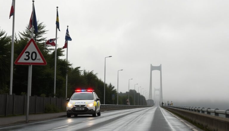
Wales is currently facing strong winds, prompting authorities to issue warnings for drivers across the region. As a precaution, speed limits have been lowered on two major bridges. This morning, the speed limit on the M4 Briton Ferry Bridge was reduced to 30 mph, affecting traffic from junction 41 A48 Pentyla-Baglan Road to junction 42 A483.
Similarly, the A55 Britannia Bridge has also seen its speed limit set at 30 mph in both directions between junction nine A487 and junction eight A5. Advisory restrictions are in place for caravans, motorbikes, and cyclists, highlighting the need for caution as conditions deteriorate.
Flood Alerts Issued Across Multiple Regions
In response to the ongoing inclement weather, Natural Resources Wales has issued six flood alerts throughout the country. These alerts target areas particularly vulnerable to flooding due to heavy rainfall and rising river levels.
The alerts include:
- 1. River Mawddach and River Wnion:Flooding of low-lying land and roads is expected, with levels currently above normal.
- 2. Conwy Valley:Rising river levels may cause flooding to properties. Advisory warnings for Gwydir Road and B5106 have been issued.
- 3. River Dee:Flooding is anticipated from Llanuwchllyn to Llangollen.
- 4. River Vyrnwy, River Tanat, and River Cain:Rising levels could affect roads near Meifod Bridge and other local routes.
- 5. River Conwy:Elevated levels pose a risk of flooding in areas from Dolwyddelan to Conwy.
- 6. River Dyfi:Flooding risks extend from Dinas Mawddwy and Llanbrynmair to the estuary, including Machynlleth.
Notably, the alert for the River Mawddach and River Wnion indicates that flooding of low-lying areas and roads is expected, with rainfall continuing to impact the region.
Weather Forecast and Expectations
The Met Office has issued a forecast for Wales, indicating a drier day with a chance of isolated showers. Sunny spells are expected in the morning, but conditions may turn hazy by the afternoon. Winds are predicted to ease throughout the morning, with maximum temperatures reaching approximately 17 °C.
As the day progresses, the forecast warns of cloudy conditions with showery rain affecting southern and western counties in the evening. A band of heavier precipitation is anticipated to spread eastward overnight, with increasing winds by dawn, dropping temperatures to a minimum of 11 °C.
AGGIORNAMENTO ORE [time]: The situation is being closely monitored, with local authorities and emergency services on high alert to respond to any incidents caused by the adverse weather, ensuring that public safety remains the top priority.
