Weather Forecast: Arctic Winds and Snow Showers Heading to the UK Get ready for a significant weather change as Arctic winds and snow showers are forecasted to impact the UK. Prepare for colder temperatures and potential snowfall in the coming days. Stay updated on the latest weather alerts and take necessary precautions to ensure safety during this shift in conditions.
The weather forecast for the UK is changing as Arctic winds and potential snow showers approach. This shift is attributed to a high-pressure system currently near the UK. While such weather patterns are typical in winter, the timing and effects of these changes warrant close attention.
Meteorologists indicate that early signs of this shift may already be present, with varying conditions expected across different regions. Mornings may begin with fog, which will clear to reveal sunny spells for some, while others may see increasing cloud cover.
Weather expectations for the upcoming days
In the coming days, the weather is expected to evolve under the influence of high pressure. However, this will soon be followed by a series of low-pressure systems moving through the North Sea, bringing rain and showers to various parts of the UK as the week progresses.
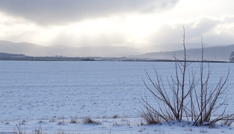
Despite the likelihood of wet weather, many regions should experience periods of settled conditions interspersed with showers. Cold air from the north will contribute to chilly temperatures, particularly at night when frost may form in some areas. Residents should prepare for a mix of weather patterns, including the potential for snow in northern coastal areas, especially at lower elevations.
Impact of Arctic conditions
The anticipated arrival of Arctic conditions could significantly alter how temperatures feel across the UK. A cold, showery northerly flow is expected to develop, leading to a drop in temperatures that may feel considerably colder than average. This effect will be pronounced in areas with clearer night skies, where frost is likely.
As cold air pushes southward, pockets of showers are predicted to spread further inland. While initial conditions may pose some wintry hazards, the overall trend suggests a drier than average period, which will be welcomed by those accustomed to wet weather.
Long-term outlook and seasonal changes
Looking ahead, the end of the month may bring more dynamic weather conditions. The current high pressure could linger initially, but as frontal systems from the Atlantic move in, the UK may experience a shift to more changeable weather patterns, possibly resulting in more frequent rain and disruptive conditions.
In the meantime, staying informed about the changing weather is essential. Residents should monitor local forecasts as meteorologists continue to track the situation closely. Given the low confidence levels in specific details, it is crucial to remain adaptable as weather patterns develop.
Monitoring flood risks
In addition to forecasts of cold and snow, certain areas are under flood warnings. These warnings are due to the increased likelihood of rainfall and the potential for rising water levels in specific regions. Those living in vulnerable areas are advised to stay updated and prepared for any emergencies that may arise.
As conditions evolve, maintaining a proactive approach and staying informed through reliable sources, such as the Met Office, will ensure that residents can respond effectively to any weather-related challenges.
