a combination of snow, ice and heavy rain has led to significant flood warnings and travel disruption; officials urge people to protect property and prioritise safety
UK Weather Alert: Snow, Ice and Rising Flood Risk
The UK is facing a tricky mix of wintry weather and flooding threats. Northern areas are under a yellow Met Office warning for snow and ice, while low-lying and riverine locations are seeing an elevated flood risk.
The Environment Agency has issued multiple flood warnings and alerts. If you live in an affected area, please stay tuned to official updates, take sensible precautions and follow emergency-service advice.
Who’s most at risk
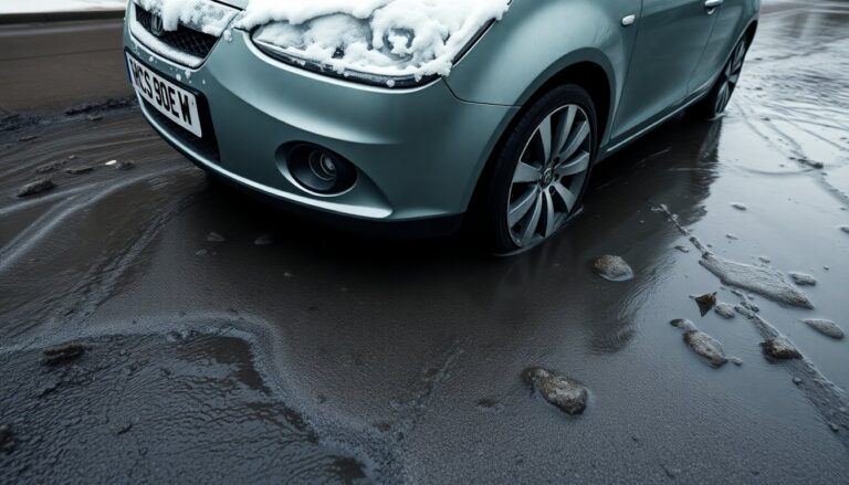
– Northern Scotland and large swathes of England are expecting snow and icy conditions that could make travel hazardous.
– Communities along major rivers and in floodplains face the greatest danger from rising water.
– Where ice and floodwater coincide, there’s an increased chance of travel disruption, property damage and even temporary power loss. Local councils and emergency teams have mobilised to support vulnerable households.
What the warnings mean
– Flood alerts mean flooding is possible and you should prepare.
– Flood warnings mean flooding is expected and you should act now to protect people and property.
– The Met Office’s yellow warning signals that snow and ice could disrupt journeys and local services; forecasts suggest roughly 1–3 cm at low levels, 3–7 cm above about 150 m, and 10–15 cm above 400 m, with an increasing chance that snow will change to rain as milder air pushes in from the west.
Current situation in numbers
Operational briefings show peaks around 74 flood warnings and 163 flood alerts, with other updates noting over 100 warnings and more than 200 alerts. Agencies report roughly 330 properties already flooded, and temporary defences and response measures protecting more than 24,000 homes and businesses.
What to expect next
– Early snow and ice over northern areas will tend to clear eastwards, but a band of heavier rain is likely to follow. Where rain falls onto frozen or already saturated ground, runoff will increase quickly, boosting the risk of river and surface-water flooding.
– Forecasters also flag a brief chance of freezing rain, which can create dangerously slippery surfaces. Upland and higher-elevation communities remain most exposed to significant snowfall and subsequent icing, while sheltered valleys may see more modest accumulation.
– Keep an eye out for targeted local updates: authorities will issue further warnings for the highest-risk places as river levels and rainfall totals evolve.
Practical steps for households
– Move people, pets and irreplaceable items to higher floors or safe locations if floodwater is approaching.
– If safe to do so, move vehicles and valuables to higher ground. Use sandbags or temporary barriers when they are available.
– Keep mobile phones charged and useful items to hand: torches, battery packs and important papers in waterproof containers. Photograph property before and after any damage for insurance purposes.
– Don’t walk or drive through flowing water — as little as 15 cm can knock an adult off their feet, and 30 cm can float a small car. Turn off utilities only if it’s safe and practical to do so.
– Register for local warning services and follow the Met Office and Environment Agency for verified guidance.
What businesses and organisations should do now
– Review and, where necessary, activate continuity plans. Prioritise relocating essential equipment from ground floors and protect key assets.
– Check insurance policies and business interruption terms. Keep records of actions taken — these can help with claims and demonstrate due diligence.
– Practical tasks: clear drains and gutters where safe, check pumps and temporary defences, confirm staff availability for rapid response, and pre-position grit and contingency crews for transport routes.
– Operators of critical infrastructure should document response decisions and notify relevant regulators if services could affect third parties.
How emergency services and councils will respond
– Emergency responders will prioritise life safety, vulnerable people and critical infrastructure. That may include road closures, deployment of temporary barriers and organised evacuations or rest centres.
– Local authorities will coordinate welfare support and shelter for displaced people. Utility companies may carry out precautionary shutdowns to reduce risk to networks.
– Community groups are encouraged to help neighbours when it’s safe to do so, but don’t put yourself in harm’s way or create extra demand on rescue services.
Travel and transport impacts
– Expect icy roads, drifting snow and standing water to cause hazardous travel conditions. Road and rail operators may impose speed restrictions, alter timetables or suspend services if safety is threatened.
– If you must travel, allow extra time, reduce speed and avoid deep water. Check operator notices before setting off.
Short-term outlook and key reminders
– Conditions should remain unsettled while Atlantic systems sweep across the region, bringing showers, hill snow and spells of rain. The north will generally stay colder; southern and southwestern areas may be milder. New systems could bring further wind and heavy rain later on.
– Rely only on official channels — the Met Office and Environment Agency — for forecasts and safety guidance. Ignore unverified reports and don’t share speculation.
– Expect additional targeted warnings as forecasts are refined. Act early where warnings are issued and keep a simple, rehearsed plan ready for rapid evacuation if needed.
Who’s most at risk
– Northern Scotland and large swathes of England are expecting snow and icy conditions that could make travel hazardous.
– Communities along major rivers and in floodplains face the greatest danger from rising water.
– Where ice and floodwater coincide, there’s an increased chance of travel disruption, property damage and even temporary power loss. Local councils and emergency teams have mobilised to support vulnerable households.0
Who’s most at risk
– Northern Scotland and large swathes of England are expecting snow and icy conditions that could make travel hazardous.
– Communities along major rivers and in floodplains face the greatest danger from rising water.
– Where ice and floodwater coincide, there’s an increased chance of travel disruption, property damage and even temporary power loss. Local councils and emergency teams have mobilised to support vulnerable households.1
